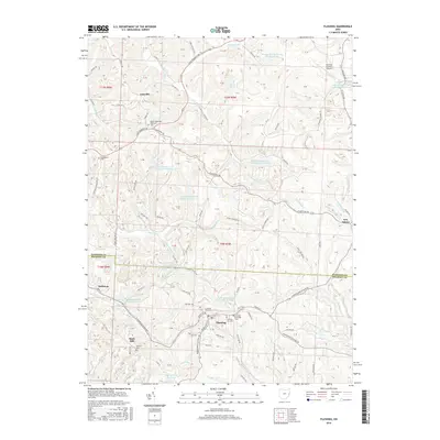
2016 Map of Flushing
USGS Topo · Published 2016About this map
The village of Flushing serves as the central hub for this portion of Harrison and Belmont counties, situated along the Flushing-Holloway Rd and the B & O Railroad Pond Dam. The landscape is defined by its industrial legacy, specifically the numerous water features associated with regional resource extraction, such as Consolidation Coal Company Pond 0110 and the Georgetown Plant Lower Supply Pond. These basins are interspersed with the headwaters of Brushy Fork and Wheeling Creek.
Find a feature on this map
124 named features on this map. Tap any name to fly to it.
Don’t see what you’re looking for? This feature index may not catch every label — zoom into the map to look around manually.
Map Details
Editions of this 2016 Flushing Map
This is the sole edition of this map. No revisions or reprints were ever made.
Other maps of this area

1901 · Cadiz
USGS Topo · 1:62,500

1902 · Scio
USGS Topo · 1:62,500

1903 · Cadiz
USGS Topo · 1:62,500

1903 · Flushing
USGS Topo · 1:62,500

1904 · Scio
USGS Topo · 1:62,500

1905 · St. Clairsville
USGS Topo · 1:62,500

1905 · Flushing
USGS Topo · 1:62,500

1951 · Canton
USGS Topo · 1:250,000

1953 · Canton
USGS Topo · 1:250,000

1957 · Canton
USGS Topo · 1:250,000