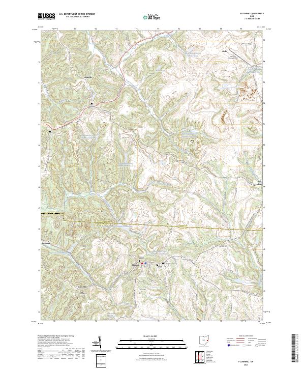
2023 Map of Flushing
USGS Topo · Published 2023About this map
Flushing and its surrounding hill country sit at the boundary of Harrison and Belmont counties, where the landscape is defined by the headwaters of several prominent creeks. The village of Flushing serves as a central hub for a network of township roads, including the Flushing-Holloway Rd and Flushing New Athens Rd. This modern survey illustrates the region's industrial and environmental character through numerous water management features like the Consolidation Coal Company Pond 0110 and the B & O Railroad Pond Dam.
Find a feature on this map
71 named features on this map. Tap any name to fly to it.
Don’t see what you’re looking for? This feature index may not catch every label — zoom into the map to look around manually.
Map Details
Editions of this 2023 Flushing Map
This is the sole edition of this map. No revisions or reprints were ever made.
Historical Maps of Cadiz Through Time
5 maps found