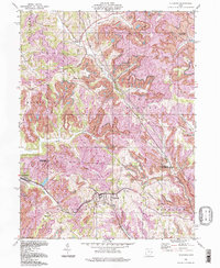
1994 Map of Flushing
USGS Topo · Published 1998About this map
The hills of eastern Ohio in the mid-1990s reveal a landscape defined by industrial extraction and small-town resilience. Deeply etched by Brushy Fork and Wheeling Creek, this area shows extensive Strip Mines that have fundamentally altered the topography between the townships of Nottingham and Athens. These massive operations dominate the space between established settlements like Flushing and Holloway, reflecting the region's long-standing economic reliance on coal.
Find a feature on this map
27 named features on this map. Tap any name to fly to it.
Don’t see what you’re looking for? This feature index may not catch every label — zoom into the map to look around manually.
Map Details
Editions of this 1994 Flushing Map
This is the sole edition of this map. No revisions or reprints were ever made.
Other maps of this area

1901 · Cadiz
USGS Topo · 1:62,500

1902 · Scio
USGS Topo · 1:62,500

1903 · Cadiz
USGS Topo · 1:62,500

1903 · Flushing
USGS Topo · 1:62,500

1904 · Scio
USGS Topo · 1:62,500

1905 · St. Clairsville
USGS Topo · 1:62,500

1905 · Flushing
USGS Topo · 1:62,500

1951 · Canton
USGS Topo · 1:250,000

1953 · Canton
USGS Topo · 1:250,000

1957 · Canton
USGS Topo · 1:250,000