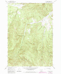
1965 Map of Fly Valley
USGS Topo · Published 1985About this map
Fly Valley and the surrounding high country of the Whitman National Forest are defined by a network of drainage systems feeding into the Grande Ronde River in northeastern Oregon. This mid-century survey reveals a landscape dedicated to resource management and livestock ranching, centered on the Vey Ranch and its nearby Landing Strip. The presence of several Gravel Pit sites and a Quarry suggest active road maintenance and infrastructure development within the national forest during this period.
Find a feature on this map
31 named features on this map. Tap any name to fly to it.
Don’t see what you’re looking for? This feature index may not catch every label — zoom into the map to look around manually.
Map Details
Editions of this 1965 Fly Valley Map
Other maps of this area

1901 · Sumpter
USGS Topo · 1:125,000

1951 · Desolation Butte
USGS Topo · 1:62,500

1953 · Pendleton
USGS Topo · 1:250,000

1955 · Canyon City
USGS Topo · 1:250,000

1956 · Pendleton
USGS Topo · 1:250,000

1959 · Canyon City
USGS Topo · 1:250,000

1965 · Limber Jim Creek
USGS Topo · 1:24,000

1965 · Marley Creek
USGS Topo · 1:24,000

1965 · Little Beaver Creek
USGS Topo · 1:24,000

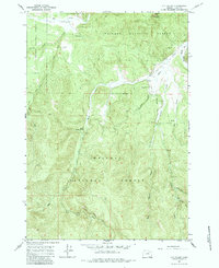
1965 · Fly Valley
USGS Topo · 1:24,000