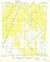
1950 Map of Foley
USGS Topo · Published 1950About this map
Missouri Pacific railroad lines and heavy timber infrastructure define this mid-century landscape in Allen Parish. The map reveals an area transition, where an extensive network of Old Logging Railroad Grade crisscrosses the terrain, marking the legacy of the local lumber industry. Small settlements such as Ward, Guy, and Richey are situated along the main rail corridor and U. S. Highway No 165, while the rural interior is dotted with local landmarks like Pine Sch and a lone Cem. Drainage for the region is provided by the meandering Calcasieu River and its various tributaries, including Chinquapin Creek and Castor Creek. This survey, compiled from aerial photography, captures the precise alignment of section lines and watercourses like Mitchell Creek and Duplechien Gully during a period of industrial change.
Find a feature on this map
16 named features on this map. Tap any name to fly to it.
Don’t see what you’re looking for? This feature index may not catch every label — zoom into the map to look around manually.
Map Details
Editions of this 1950 Foley Map
This is the sole edition of this map. No revisions or reprints were ever made.
Other maps of this area

1935 · Beaver
USGS Topo · 1:31,680

1935 · Oakdale
USGS Topo · 1:31,680

1942 · Oakdale
USGS Topo · 1:62,500

1947 · Fruge Lake
USGS Topo · 1:31,680

1947 · Foley
USGS Topo · 1:31,680

1947 · Oberlin
USGS Topo · 1:31,680

1947 · Pine Chapel
USGS Topo · 1:31,680

1947 · Bond
USGS Topo · 1:31,680

1947 · Elizabeth
USGS Topo · 1:31,680

1948 · Elizabeth
USGS Topo · 1:24,000