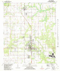
1980 Map of Foley
USGS Topo · Published 1981About this map
The agrarian and aviation landscape of Baldwin County is anchored by the growing municipalities of Foley and Summerdale. This 1980 survey reveals a region defined by its transit corridors and water systems, where the Louisville and Nashville railroad runs parallel to the primary north-south highway, linking local agricultural fields to broader markets. The topography is marked by several aviation landmarks, including the Foley Municipal Airport, Wilson Field, and the specialized OLF Barin U S Naval Reservation in the southeast corner.
Find a feature on this map
28 named features on this map. Tap any name to fly to it.
Don’t see what you’re looking for? This feature index may not catch every label — zoom into the map to look around manually.
Map Details
Editions of this 1980 Foley Map
2 editions found
Other maps of this area

1920 · Robertsdale
USGS Topo · 1:62,500

1921 · Bon Secour
USGS Topo · 1:62,500

1921 · Point Clear
USGS Topo · 1:62,500

1921 · Fairhope
USGS Topo · 1:62,500

1940 · Silverhill
USGS Topo · 1:31,680

1941 · Silverhill
USGS Topo · 1:31,680

1941 · Robertsdale
USGS Topo · 1:62,500

1941 · Foley
USGS Topo · 1:62,500

1941 · Weeks Bay
USGS Topo · 1:62,500

1941 · Fairhope
USGS Topo · 1:62,500