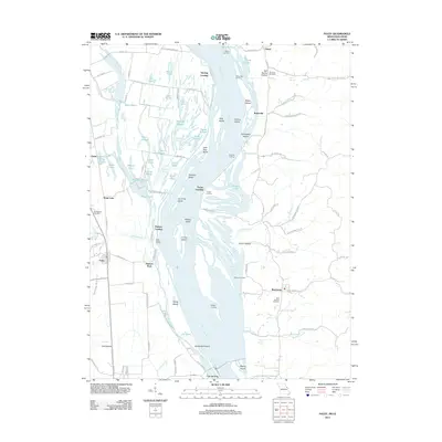
2011 Map of Foley
USGS Topo · Published 2011About this map
Mississippi River braided channels and expansive floodplains define this borderland where Missouri meets Illinois. The river serves as a central artery for the region, flanked by a complex system of side-channels and backwaters including Sandy Chute, Sandy Slough, and Dogfish Slough. The landscape is dotted with several river access points like Sterling Landing, Turner Landing, and Wilson Landing, reflecting a long history of waterborne commerce and transport between Foley on the western bank and Batchtown to the east.
Find a feature on this map
113 named features on this map. Tap any name to fly to it.
Don’t see what you’re looking for? This feature index may not catch every label — zoom into the map to look around manually.
Map Details
Editions of this 2011 Foley Map
This is the sole edition of this map. No revisions or reprints were ever made.
Other maps of this area

1903 · O'Fallon
USGS Topo · 1:125,000

1930 · Hardin
USGS Topo · 1:62,500

1931 · Brussels
USGS Topo · 1:62,500

1934 · Elsberry
USGS Topo · 1:48,000

1934 · Hardin
USGS Topo · 1:62,500

1938 · Hardin
USGS Topo · 1:62,500

1939 · Brussels
USGS Topo · 1:62,500

1941 · Troy
USGS Topo · 1:62,500

1942 · Elsberry
USGS Topo · 1:62,500

1943 · Brussels
USGS Topo · 1:62,500