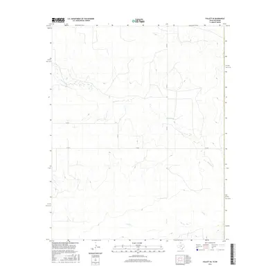
2016 Map of Follett SE
USGS Topo · Published 2016About this map
Mammoth Cr and Wolf Cr define the drainage patterns of this rural landscape in the eastern panhandle. The area is characterized by a sparse network of section-line roads and state infrastructure, centered on the crossing of Fm 3004 and several county routes. These waterways, including the smaller Bridge Cr, carve through the terrain, illustrating the natural hydrological features that dictate the land's usage. The prevalence of named county roads like Co Rd 29 and Co Rd 27 highlights the organized grid of this agricultural region, where the intersection of water and roadway remains the primary focus of human activity.
Find a feature on this map
7 named features on this map. Tap any name to fly to it.
Don’t see what you’re looking for? This feature index may not catch every label — zoom into the map to look around manually.
Map Details
Editions of this 2016 Follett SE Map
This is the sole edition of this map. No revisions or reprints were ever made.
Other maps of this area

1954 · Perryton
USGS Topo · 1:250,000

1955 · Woodward
USGS Topo · 1:250,000

1958 · Perryton
USGS Topo · 1:250,000

1958 · Woodward
USGS Topo · 1:250,000

1969 · Shattuck
USGS Topo · 1:24,000

1969 · Shattuck NW
USGS Topo · 1:24,000

1970 · Goodwin
USGS Topo · 1:24,000

1972 · Follett SE
USGS Topo · 1:24,000

1972 · Skunk Creek
USGS Topo · 1:24,000
1972 · Magoun
USGS Topo · 1:24,000