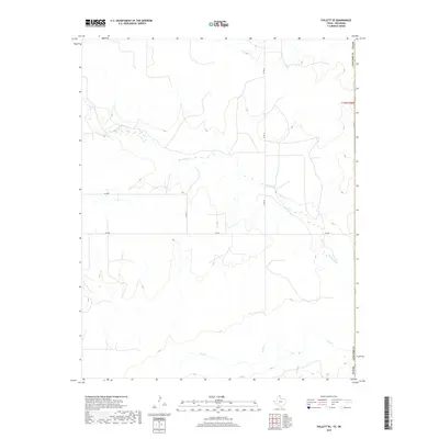
2019 Map of Follett SE
USGS Topo · Published 2019About this map
Wolf Cr and Mammoth Cr define the hydrological character of this landscape in Ellis County, Oklahoma, shortly before the end of the decade. The map reveals a highly structured grid of section roads and farm-to-market routes typical of the High Plains, where agricultural development is organized around watercourses. While much of the terrain remains open, the infrastructure is dominated by a systematic network including FM 3004 and several county roads such as Co Rd 27 and Co Rd 29. This survey provides a precise view of the land partitions and the drainage patterns of Bridge Cr as they appeared in 2019, reflecting the enduring rural character of the Panhandle region near the Texas state line.
Find a feature on this map
10 named features on this map. Tap any name to fly to it.
Don’t see what you’re looking for? This feature index may not catch every label — zoom into the map to look around manually.
Map Details
Editions of this 2019 Follett SE Map
This is the sole edition of this map. No revisions or reprints were ever made.
Other maps of this area

1954 · Perryton
USGS Topo · 1:250,000

1955 · Woodward
USGS Topo · 1:250,000

1958 · Perryton
USGS Topo · 1:250,000

1958 · Woodward
USGS Topo · 1:250,000

1969 · Shattuck
USGS Topo · 1:24,000

1969 · Shattuck NW
USGS Topo · 1:24,000

1970 · Goodwin
USGS Topo · 1:24,000

1972 · Follett SE
USGS Topo · 1:24,000

1972 · Skunk Creek
USGS Topo · 1:24,000
1972 · Magoun
USGS Topo · 1:24,000