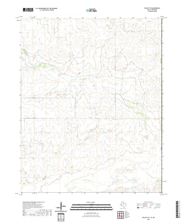
2022 Map of Follett SE
USGS Topo · Published 2022About this map
Mammoth Cr meanders across the northern reaches of this Panhandle landscape, shaping the local topography of Lipscomb Co along the border where Texas meets Oklahoma. The terrain is defined by the drainage basins of several watercourses, including Wolf Cr and Bridge Cr to the south. This modern survey illustrates the sparse but critical transportation network that serves this rural ranching and agricultural region. Section lines and rectangular surveys are evident through the placement of county routes like Co Rd N, Co Rd 27, and Co Rd 29, which grid the open country between the creek beds. Fm 3004 provides the primary east-west passage, while Ns 169 runs along the state line, highlighting the intersection of local infrastructure and geographic boundaries.
Find a feature on this map
11 named features on this map. Tap any name to fly to it.
Don’t see what you’re looking for? This feature index may not catch every label — zoom into the map to look around manually.
Map Details
Editions of this 2022 Follett SE Map
This is the sole edition of this map. No revisions or reprints were ever made.
Other maps of this area

1954 · Perryton
USGS Topo · 1:250,000

1955 · Woodward
USGS Topo · 1:250,000

1958 · Perryton
USGS Topo · 1:250,000

1958 · Woodward
USGS Topo · 1:250,000

1969 · Shattuck
USGS Topo · 1:24,000

1969 · Shattuck NW
USGS Topo · 1:24,000

1970 · Goodwin
USGS Topo · 1:24,000

1972 · Follett SE
USGS Topo · 1:24,000

1972 · Skunk Creek
USGS Topo · 1:24,000
1972 · Magoun
USGS Topo · 1:24,000