
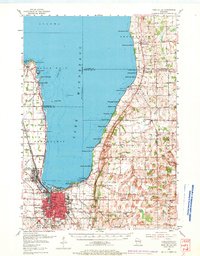
1955 Map of Fond Du Lac
USGS Topo · Published 1957About this map
The eastern shores of Winnebago Lake dominate this 1955 survey, where the city of Fond du Lac meets the water through a dense network of residential streets and industrial infrastructure. The waterfront is defined by a series of recreation-focused settlements like Highland Park and Winnebago Park, while the southern marshlands are protected by the Supple Marsh. Transportation hubs are prominent, including the Fond du Lac Airport and the Sky Harbor Seaplane Base, reflecting a post-war era of aviation expansion alongside established rail lines like the Chicago and North Western.
Find a feature on this map
116 named features on this map. Tap any name to fly to it.
Don’t see what you’re looking for? This feature index may not catch every label — zoom into the map to look around manually.
Map Details
Editions of this 1955 Fond Du Lac Map
2 editions found
Other maps of this area

1910 · Fond du Lac
USGS Topo · 1:62,500

1911 · Neenah
USGS Topo · 1:62,500

1954 · Chilton
USGS Topo · 1:62,500

1954 · Kiel
USGS Topo · 1:62,500

1955 · Neenah
USGS Topo · 1:62,500

1955 · Waupun
USGS Topo · 1:62,500

1955 · Campbellsport
USGS Topo · 1:62,500

1955 · Kewaskum
USGS Topo · 1:62,500

1955 · Fond Du Lac
USGS Topo · 1:24,000

1955 · Green Bay
USGS Topo · 1:250,000