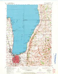
1955 Map of Fond Du Lac
USGS Topo · Published 1971About this map
Lake Winnebago dominates this mid-century survey, its eastern shore lined with seasonal and residential developments from Winnebago Park down to Hopokoekau Beach. The city of Fond du Lac serves as the regional anchor, showing a dense grid of neighborhood schools like Bragg Sch and Lincoln Sch alongside industrial infrastructure like the Soo Line and Chicago and North Western railroads.
Find a feature on this map
97 named features on this map. Tap any name to fly to it.
Don’t see what you’re looking for? This feature index may not catch every label — zoom into the map to look around manually.
Map Details
Editions of this 1955 Fond Du Lac Map
2 editions found
Other maps of this area

1910 · Fond du Lac
USGS Topo · 1:62,500

1911 · Neenah
USGS Topo · 1:62,500

1954 · Chilton
USGS Topo · 1:62,500

1954 · Kiel
USGS Topo · 1:62,500

1955 · Neenah
USGS Topo · 1:62,500

1955 · Waupun
USGS Topo · 1:62,500

1955 · Campbellsport
USGS Topo · 1:62,500

1955 · Kewaskum
USGS Topo · 1:62,500

1955 · Fond Du Lac
USGS Topo · 1:62,500

1955 · Fond Du Lac
USGS Topo · 1:24,000