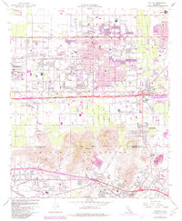
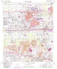
1967 Map of Fontana
USGS Topo · Published 1980About this map
The Kaiser Steel Plant dominates the industrial landscape west of Fontana, a city defined by its heavy manufacturing base and grid-like residential growth during the mid-20th century. This territory spans the San Bernardino and Riverside County line, stretching from the foothills south toward the Santa Ana River. The area's economic backbone is clearly visible through the dual rail corridors of the Southern Pacific and the Atchison Topeka and Santa Fe, which service the sprawling mills and local quarries.
Find a feature on this map
61 named features on this map. Tap any name to fly to it.
Don’t see what you’re looking for? This feature index may not catch every label — zoom into the map to look around manually.
Map Details
Editions of this 1967 Fontana Map
5 editions found
Other maps of this area

1896 · San Bernardino
USGS Topo · 1:62,500

1897 · Cucamonga
USGS Topo · 1:62,500

1898 · San Bernardino
USGS Topo · 1:62,500

1900 · Cucamonga
USGS Topo · 1:62,500

1901 · Southern California Sheet No. 1
USGS Topo · 1:250,000

1901 · San Bernardino
USGS Topo · 1:62,500

1901 · Elsinore
USGS Topo · 1:125,000

1901 · Riverside
USGS Topo · 1:62,500

1902 · Corona
USGS Topo · 1:125,000

1903 · Cucamonga
USGS Topo · 1:62,500