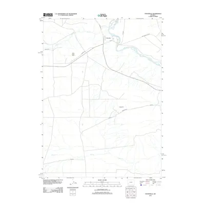
2012 Map of Fontenelle
USGS Topo · Published 2012About this map
Green River flows through this southwestern Wyoming landscape, marking a critical corridor for both historic passage and modern industry. The small settlement of Fontenelle is situated near the riverbanks, serving as a focal point in an area defined by wide basins and significant terrain features like Dodge Rim and Slate Creek Butte. The map highlights a layered transportation history, where the ancient path of the Emigrant Trl is intersected by contemporary infrastructure such as Exxon Plant Rd. This intersection illustrates the evolution of the land from a pioneer thoroughfare to a site of energy production. Drainage systems including Slate Cr and Shute Cr feed into the primary river valley, while a network of rural routes like Lower Farson Cutoff Rd connects this high-desert region to the broader county.
Find a feature on this map
15 named features on this map. Tap any name to fly to it.
Don’t see what you’re looking for? This feature index may not catch every label — zoom into the map to look around manually.
Map Details
Editions of this 2012 Fontenelle Map
This is the sole edition of this map. No revisions or reprints were ever made.
Other maps of this area

1954 · Ogden
USGS Topo · 1:250,000

1954 · Rock Springs
USGS Topo · 1:250,000

1955 · Preston
USGS Topo · 1:250,000

1955 · Lander
USGS Topo · 1:250,000

1958 · Lander
USGS Topo · 1:250,000

1958 · Ogden
USGS Topo · 1:250,000

1958 · Rock Springs
USGS Topo · 1:250,000

1958 · Preston
USGS Topo · 1:250,000

1960 · Ogden
USGS Topo · 1:250,000

1961 · Lander
USGS Topo · 1:250,000