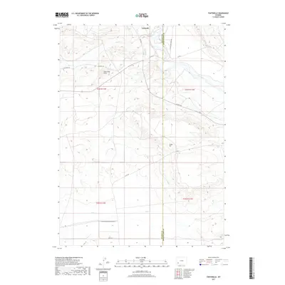
2017 Map of Fontenelle
USGS Topo · Published 2017About this map
Green River flows through the high desert landscape of southwestern Wyoming, marking the boundary between Lincoln and Sweetwater Counties. Near the settlement of Fontenelle, the river's winding path is flanked by prominent landforms such as Dodge Rim and Slate Creek Butte. This area has long served as a corridor for travel and migration, evidenced by the convergence of several historical and modern routes. The Emigrant Trl and Slate Creek Trl cut across the plateau, following the drainages of Slate Cr toward the river crossing. These paths reflect the deep history of westward expansion where natural water sources and favorable terrain dictated the movement of pioneers and later cattle ranchers along La Barge Rd.
Find a feature on this map
18 named features on this map. Tap any name to fly to it.
Don’t see what you’re looking for? This feature index may not catch every label — zoom into the map to look around manually.
Map Details
Editions of this 2017 Fontenelle Map
This is the sole edition of this map. No revisions or reprints were ever made.
Other maps of this area

1954 · Ogden
USGS Topo · 1:250,000

1954 · Rock Springs
USGS Topo · 1:250,000

1955 · Preston
USGS Topo · 1:250,000

1955 · Lander
USGS Topo · 1:250,000

1958 · Lander
USGS Topo · 1:250,000

1958 · Ogden
USGS Topo · 1:250,000

1958 · Rock Springs
USGS Topo · 1:250,000

1958 · Preston
USGS Topo · 1:250,000

1960 · Ogden
USGS Topo · 1:250,000

1961 · Lander
USGS Topo · 1:250,000