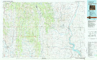
1982 Map of Fontenelle Reservoir
USGS Topo · Published 1982About this map
The Fontenelle Reservoir and the Green River valley dominate the eastern landscape of this Wyoming region, where high desert plateaus meet the ridges of the Bridger National Forest. Historically significant transport corridors cross this terrain, most notably the Emigrant Trail and the Sublette Cutoff, which provide a clear record of the westward movement through Lincoln and Sublette counties. These paths represent a deep layer of history alongside the industrial infrastructure of the early 1980s, including the Union Pacific RR near Cokeville.
Find a feature on this map
142 named features on this map. Tap any name to fly to it.
Don’t see what you’re looking for? This feature index may not catch every label — zoom into the map to look around manually.
Map Details
Editions of this 1982 Fontenelle Reservoir Map
2 editions found
Other maps of this area

1909 · Montpelier
USGS Topo · 1:125,000

1911 · Montpelier
USGS Topo · 1:125,000

1912 · Randolph
USGS Topo · 1:125,000

1915 · Crow Creek
USGS Topo · 1:62,500

1921 · Afton
USGS Topo · 1:125,000

1936 · Cokeville
USGS Topo · 1:96,000

1939 · Big Piney
USGS Topo · 1:125,000

1942 · Cokeville
USGS Topo · 1:125,000

1942 · Big Piney
USGS Topo · 1:125,000

1945 · Fort Hill
USGS Topo · 1:62,500