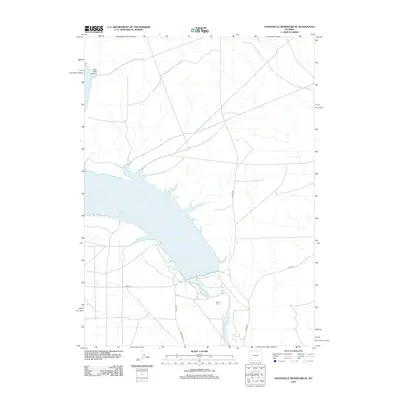
2012 Map of Fontenelle Reservoir SE
USGS Topo · Published 2012About this map
The Green River flows through this high desert region of Sweetwater County, dominated by the expansive waters of the Fontenelle Reservoir. This 2012 survey illustrates the modern hydrology and infrastructure of the area, showing where the river's course is interrupted by the reservoir's southern reach. To the west, the sharp elevation changes of Case Knife Canyon create a distinct geological break in the landscape. Local history and genealogy interest is anchored by the Whitman Cem, located south of the reservoir's primary basin. The map tracks a network of rural access routes, including Co Line Rd and 18 Mile Rd, which navigate the arid terrain surrounding the reservoir. These roads serve as the primary arteries for this sparsely populated section of Wyoming, connecting isolated landmarks and the managed water resources of the Upper Green River Basin.
Find a feature on this map
9 named features on this map. Tap any name to fly to it.
Don’t see what you’re looking for? This feature index may not catch every label — zoom into the map to look around manually.
Map Details
Editions of this 2012 Fontenelle Reservoir SE Map
This is the sole edition of this map. No revisions or reprints were ever made.
Other maps of this area

1954 · Ogden
USGS Topo · 1:250,000

1954 · Rock Springs
USGS Topo · 1:250,000

1955 · Preston
USGS Topo · 1:250,000

1955 · Lander
USGS Topo · 1:250,000

1958 · Lander
USGS Topo · 1:250,000

1958 · Ogden
USGS Topo · 1:250,000

1958 · Rock Springs
USGS Topo · 1:250,000

1958 · Preston
USGS Topo · 1:250,000

1960 · Ogden
USGS Topo · 1:250,000

1961 · Lander
USGS Topo · 1:250,000