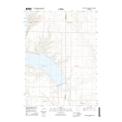
2015 Map of Fontenelle Reservoir SE
USGS Topo · Published 2015About this map
Fontenelle Reservoir dominates this high-desert landscape in southwestern Wyoming, where the waters of the Green River are impounded across the border of Lincoln and Sweetwater counties. This 2015 survey documents the shoreline and surrounding infrastructure, including the Fontenelle Dr crossing just south of the main pool. To the northwest, the terrain rises into the distinct formation of Case Knife Canyon. A significant point of interest for genealogists and local historians is the Whitman Cem, situated on the eastern bank of the river south of the reservoir. The map provides a clear record of the modern road network, featuring Co Line Rd and several county routes that serve this sparsely settled area. The transition from the rugged canyon lands to the managed water levels of the reservoir reflects the ongoing importance of the Green River system to the region's geography and water management.
Find a feature on this map
16 named features on this map. Tap any name to fly to it.
Don’t see what you’re looking for? This feature index may not catch every label — zoom into the map to look around manually.
Map Details
Editions of this 2015 Fontenelle Reservoir SE Map
This is the sole edition of this map. No revisions or reprints were ever made.
Other maps of this area

1954 · Ogden
USGS Topo · 1:250,000

1954 · Rock Springs
USGS Topo · 1:250,000

1955 · Preston
USGS Topo · 1:250,000

1955 · Lander
USGS Topo · 1:250,000

1958 · Lander
USGS Topo · 1:250,000

1958 · Ogden
USGS Topo · 1:250,000

1958 · Rock Springs
USGS Topo · 1:250,000

1958 · Preston
USGS Topo · 1:250,000

1960 · Ogden
USGS Topo · 1:250,000

1961 · Lander
USGS Topo · 1:250,000