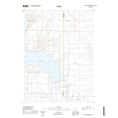
2018 Map of Fontenelle Reservoir SE
USGS Topo · Published 2018About this map
Fontenelle Reservoir dominates the high desert landscape of the Upper Green River Basin, a central feature of the infrastructure within Sweetwater County. The impounded waters are held by the Fontenelle Dam at the southern end of the reservoir, where the Green River continues its course southward. This 2018 survey reveals a sparse network of county infrastructure, including Co Line Rd and Lincoln Sweetwater Rd, which skirt the boundary between Lincoln and Sweetwater counties. To the northwest, the terrain transitions toward the breaks of Case Knife Canyon. For genealogists and local historians, the Whitman Cem stands as a significant point of interest, situated on the eastern banks of the river just below the dam. The map details a landscape primarily defined by topography and water management, with few structures outside of these primary landmarks.
Find a feature on this map
16 named features on this map. Tap any name to fly to it.
Don’t see what you’re looking for? This feature index may not catch every label — zoom into the map to look around manually.
Map Details
Editions of this 2018 Fontenelle Reservoir SE Map
This is the sole edition of this map. No revisions or reprints were ever made.
Other maps of this area

1954 · Ogden
USGS Topo · 1:250,000

1954 · Rock Springs
USGS Topo · 1:250,000

1955 · Preston
USGS Topo · 1:250,000

1955 · Lander
USGS Topo · 1:250,000

1958 · Lander
USGS Topo · 1:250,000

1958 · Ogden
USGS Topo · 1:250,000

1958 · Rock Springs
USGS Topo · 1:250,000

1958 · Preston
USGS Topo · 1:250,000

1960 · Ogden
USGS Topo · 1:250,000

1961 · Lander
USGS Topo · 1:250,000