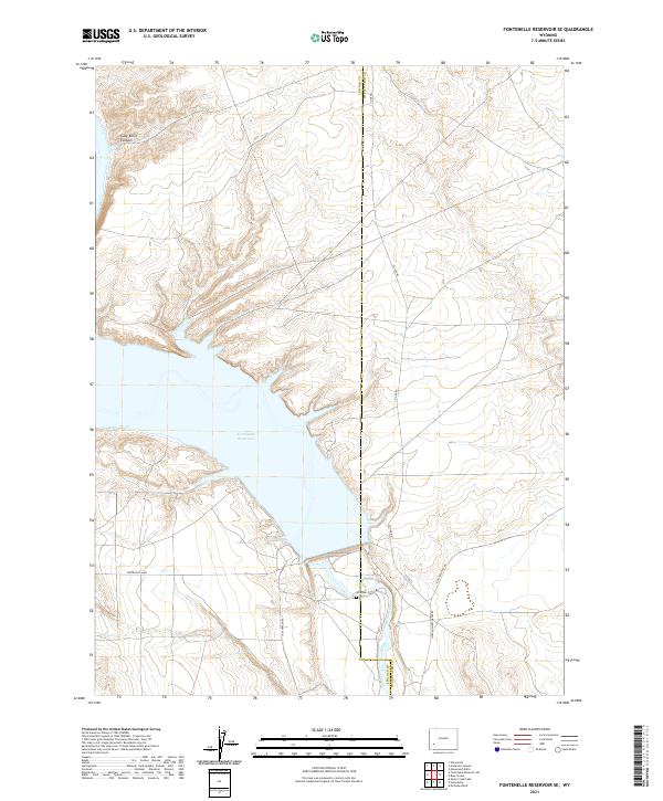
2021 Map of Fontenelle Reservoir SE
USGS Topo · Published 2021About this map
Fontenelle Reservoir dominates this high-desert landscape in southwestern Wyoming, where the Green River was impounded to manage water for the Upper Colorado River Basin. The massive Fontenelle Dam at the southern end of the pool controls the flow into the river valley below, marking a significant engineering presence in a region historically used for open-range grazing. Along the eastern bluffs, the Whitman Cem offers a rare genealogical link to the early homesteading and ranching families who lived along the river before the basin was flooded.
Find a feature on this map
16 named features on this map. Tap any name to fly to it.
Don’t see what you’re looking for? This feature index may not catch every label — zoom into the map to look around manually.
Map Details
Editions of this 2021 Fontenelle Reservoir SE Map
This is the sole edition of this map. No revisions or reprints were ever made.
Other maps of this area

1954 · Ogden
USGS Topo · 1:250,000

1954 · Rock Springs
USGS Topo · 1:250,000

1955 · Preston
USGS Topo · 1:250,000

1955 · Lander
USGS Topo · 1:250,000

1958 · Lander
USGS Topo · 1:250,000

1958 · Ogden
USGS Topo · 1:250,000

1958 · Rock Springs
USGS Topo · 1:250,000

1958 · Preston
USGS Topo · 1:250,000

1960 · Ogden
USGS Topo · 1:250,000

1961 · Lander
USGS Topo · 1:250,000