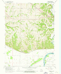
1961 Map of Forbes
USGS Topo · Published 1973About this map
The Burlington Northern railroad corridor defines the lower landscape of this Holt County region, running parallel to the broad Missouri River and its expansive Burr Oak Bottom. In the early 1960s, the community of Forbes sat at the base of a series of ridges, just north of the rail lines and the wide river bends that separate Missouri from Kansas. Further inland, the terrain is deeply dissected by numerous watercourses like Rock Creek, Hickory Creek, and Easter Creek, which created a series of hollows and heights that dictated the placement of early rural infrastructure. Genealogists and local historians will find several distinct burial sites and community centers throughout these hills, including Brodbeck Cem, Highland Cem, and Forbes Cem. The distribution of rural schools such as Highland Sch and Monarch Sch indicates a landscape once dotted with small, decentralized farming communities.
Find a feature on this map
41 named features on this map. Tap any name to fly to it.
Don’t see what you’re looking for? This feature index may not catch every label — zoom into the map to look around manually.
Map Details
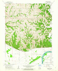
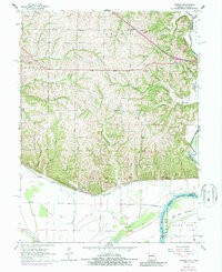
Editions of this 1961 Forbes Map
3 editions found
Other maps of this area

1885 · Atchison
USGS Topo · 1:125,000

1888 · Atchison
USGS Topo · 1:125,000

1893 · Atchison
USGS Topo · 1:125,000

1924 · St. Joseph
USGS Topo · 1:62,500

1926 · Saint Joseph
USGS Topo · 1:62,500

1926 · Oregon
USGS Topo · 1:62,500

1926 · Maitland
USGS Topo · 1:62,500

1927 · Bolckow
USGS Topo · 1:62,500

1945 · Bolckow
USGS Topo · 1:62,500

1950 · Kansas City
USGS Topo · 1:250,000