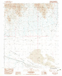
1983 Map of Ford Dry Lake
USGS Topo · Published 1983About this map
The Palen Mountains dominate the northern landscape of this Riverside County region, overlooking the expansive Chuckwalla Valley (Depression). The terrain is defined by a network of ephemeral watercourses labeled as Dry Wash that drain toward the south. Near the bottom of the basin, the Ford Dry Lake serves as a natural catchment point for these seasonal flows, illustrating the typical arid drainage patterns of the California desert during the early 1980s.
Find a feature on this map
12 named features on this map. Tap any name to fly to it.
Don’t see what you’re looking for? This feature index may not catch every label — zoom into the map to look around manually.
Map Details
Editions of this 1983 Ford Dry Lake Map
2 editions found
Other maps of this area

1942 · Blythe
USGS Topo · 1:250,000

1945 · Midland
USGS Topo · 1:62,500

1952 · Midland
USGS Topo · 1:62,500

1952 · Mc Coy Spring
USGS Topo · 1:62,500

1952 · Sidewinder Well
USGS Topo · 1:62,500

1952 · Palen Mountains
USGS Topo · 1:62,500

1954 · Salton Sea
USGS Topo · 1:250,000

1955 · Salton Sea
USGS Topo · 1:250,000

1959 · Salton Sea
USGS Topo · 1:250,000

1963 · Salton Sea
USGS Topo · 1:250,000