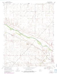
1969 Map of Ford
USGS Topo · Published 1984About this map
Ford stands at the junction of rail and river in this late-1960s landscape, where the St Louis Southwestern line parallels the winding course of the Arkansas River. The terrain is defined by the broad river valley and the convergence of Mulberry Creek from the south. The economic activity of the era is evident in the industrial footprints scattered across the township, including several Gravel Pits and a Sandpit situated near the riverbanks.
Find a feature on this map
13 named features on this map. Tap any name to fly to it.
Don’t see what you’re looking for? This feature index may not catch every label — zoom into the map to look around manually.
Map Details
Editions of this 1969 Ford Map
2 editions found
Other maps of this area

1892 · Spearville
USGS Topo · 1:125,000

1894 · Spearville
USGS Topo · 1:125,000

1955 · Pratt
USGS Topo · 1:250,000

1959 · Pratt
USGS Topo · 1:250,000
1969 · Fort Dodge SW
USGS Topo · 1:24,000

1969 · Fort Dodge
USGS Topo · 1:24,000

1969 · Bucklin
USGS Topo · 1:24,000

1969 · Kingsdown
USGS Topo · 1:24,000

1969 · Bucklin NW
USGS Topo · 1:24,000

1969 · Ford
USGS Topo · 1:24,000