
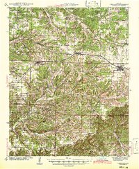
1942 Map of Fordland
USGS Topo · Published 1942About this map
Fordland and Seymour serve as the primary hubs in this late 1930s survey, connected by the St Louis San Francisco railroad. The landscape is defined by the headwaters of Finley Creek and its many tributaries, such as Davis Creek and Little Finley Creek, which carve through the Ozark highlands. This era reveals a densely populated rural environment, indicated by a remarkable concentration of country schools including McHaffie Sch, Silver Shade Sch, and Mountain Dale Sch. These institutions, alongside churches like Union Chapel and Temple Hill Ch, anchored the social life of small communities like Diggins, Zenar, and Elkhead. For researchers, the presence of family-named burial grounds such as Childress Cem and Winingham Cem provides critical genealogical coordinates. The map also captures the topography leading to Keyger Mtn, illustrating the transition from upland plateaus to the deeper creek valleys of Webster Co and Christian Co.
Find a feature on this map
76 named features on this map. Tap any name to fly to it.
Don’t see what you’re looking for? This feature index may not catch every label — zoom into the map to look around manually.
Map Details
Editions of this 1942 Fordland Map
2 editions found
Other maps of this area

1884 · Springfield
USGS Topo · 1:125,000

1886 · Springfield
USGS Topo · 1:125,000

1907 · Forsyth
USGS Topo · 1:125,000

1936 · Ava
USGS Topo · 1:48,000

1937 · Bradleyville
USGS Topo · 1:48,000

1937 · Ozark
USGS Topo · 1:48,000

1939 · Fordland
USGS Topo · 1:62,500

1942 · Ava
USGS Topo · 1:62,500

1943 · Ozark
USGS Topo · 1:62,500

1943 · Bradleyville
USGS Topo · 1:62,500