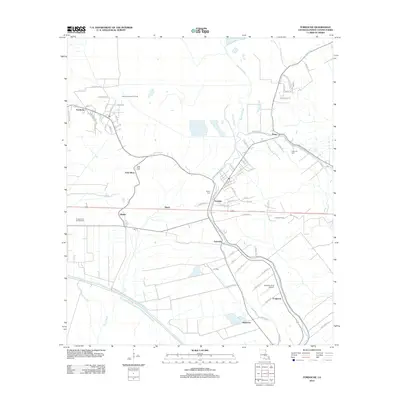
2012 Map of Fordoche
USGS Topo · Published 2012About this map
The low-lying alluvial landscape of Pointe Coupee Parish is defined by a dense network of sluggish waterways and industrial development in the early 21st century. Livonia and Fordoche serve as the primary hubs, surrounded by active energy extraction zones including the Bayou Fordoche Oil Field, Frisco Oil Field, and Livonia Oil Field. The terrain is etched with bayous such as Bayou Portage and Bayou Blue, while the local genealogy is anchored by the False River Cem and Bailey Cem. Small settlements like Blanks, Quick, and Valverda are connected by a grid of rural roads and rail lines, including the distinctive Iris Spur. The presence of the Valverda Strip Airport and several named spurs like Frogmore and Kenmore reflect the specialized agricultural and transport needs of this river-bound region.
Find a feature on this map
77 named features on this map. Tap any name to fly to it.
Don’t see what you’re looking for? This feature index may not catch every label — zoom into the map to look around manually.
Map Details
Editions of this 2012 Fordoche Map
This is the sole edition of this map. No revisions or reprints were ever made.
Other maps of this area

1906 · Bayou Sara
USGS Topo · 1:125,000

1935 · Osca Bayou
USGS Topo · 1:62,500

1939 · Fordoche
USGS Topo · 1:62,500

1940 · Grosse Tete
USGS Topo · 1:62,500

1953 · Maringouin
USGS Topo · 1:24,000

1953 · New Roads
USGS Topo · 1:24,000

1954 · Fordoche
USGS Topo · 1:24,000

1954 · Erwinville
USGS Topo · 1:24,000

1954 · Grosse Tete
USGS Topo · 1:24,000

1954 · Baton Rouge
USGS Topo · 1:250,000