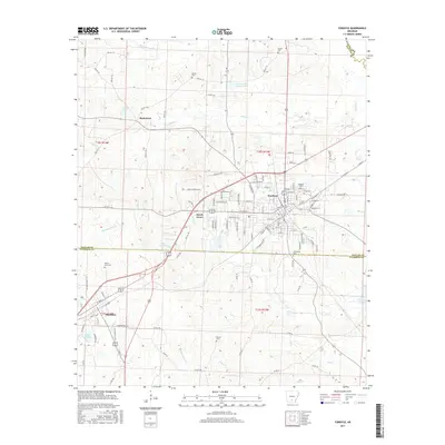
2017 Map of Fordyce
USGS Topo · Published 2017About this map
Fordyce serves as the central hub of this Dallas County landscape, where the town's street grid is flanked by the smaller communities of Thornton, Beech Grove, and Bucksnort. The area is characterized by an intricate network of timber-country creeks, including Cooks Cr, Champagnolle Cr, and Whitewater Cr, which drain the low-lying terrain into reservoirs like Lake Lansdale and Tri-County Lake. Local genealogy is well-represented through numerous burial sites such as Oakland Cem, Barnes Cem, and Greenville Cem, providing a spatial record of family settlements across the county lines.
Find a feature on this map
117 named features on this map. Tap any name to fly to it.
Don’t see what you’re looking for? This feature index may not catch every label — zoom into the map to look around manually.
Map Details
Editions of this 2017 Fordyce Map
This is the sole edition of this map. No revisions or reprints were ever made.
Other maps of this area

1903 · Camden
USGS Topo · 1:125,000

1953 · El Dorado
USGS Topo · 1:250,000

1957 · El Dorado
USGS Topo · 1:250,000

1958 · El Dorado
USGS Topo · 1:250,000

1960 · El Dorado
USGS Topo · 1:250,000

1966 · Kingsland
USGS Topo · 1:24,000

1966 · Fordyce
USGS Topo · 1:24,000
1969 · Ivan
USGS Topo · 1:24,000
1970 · Fordyce NE
USGS Topo · 1:24,000

1973 · Bearden
USGS Topo · 1:24,000