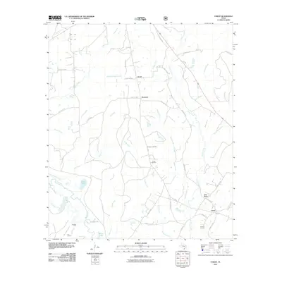
2010 Map of Forest
USGS Topo · Published 2010About this map
The Neches River defines the southwestern reaches of this East Texas landscape, where the Old River Channel and Big Slough weave through a network of wetlands and ponds including Grassy Pond and McCall Lake. Small communities such as Morrill, Brunswick, and Forest are connected by a grid of rural roads and forest service routes, reflecting the region's long-standing ties to the timber and agricultural industries. The terrain is deeply carved by a dense hydrological system, with Sulphur Creek, Larrison Creek, and Sandy Creek draining into the river basin.
Find a feature on this map
56 named features on this map. Tap any name to fly to it.
Don’t see what you’re looking for? This feature index may not catch every label — zoom into the map to look around manually.
Map Details
Editions of this 2010 Forest Map
This is the sole edition of this map. No revisions or reprints were ever made.
Other maps of this area

1946 · Alto
USGS Topo · 1:62,500

1950 · Kennard NE
USGS Topo · 1:24,000

1950 · Ratcliff
USGS Topo · 1:24,000

1951 · Wells
USGS Topo · 1:24,000

1951 · Kennard NE
USGS Topo · 1:24,000

1951 · Ratcliff
USGS Topo · 1:24,000

1952 · Douglass
USGS Topo · 1:62,500

1953 · Palestine
USGS Topo · 1:250,000

1957 · Palestine
USGS Topo · 1:250,000
1973 · Pryor Mountain
USGS Topo · 1:24,000