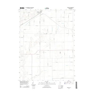
2015 Map of Forest City
USGS Topo · Published 2015About this map
Forest City serves as the primary hub of this Mason County landscape, where the grid of the town site meets an extensive network of managed waterways. The terrain is defined by a sophisticated system of drainage, including the Mason Tazewell Drainage Ditch and N Quiver Ditch, which converted the low-lying areas into productive land. This transformation of the environment is further evidenced by the naming of various lateral channels like Waldmeier Ditch and White and Brown Ditch. Elevated relief is rare in this region, notably marked by Red Oak Ridge to the southeast. For genealogists, the survey identifies the Pleasant Hill Cem located south of the main settlement. The map reflects a meticulously planned rural infrastructure where county roads and irrigation canals dictate the movement and utility of the central Illinois countryside.
Find a feature on this map
62 named features on this map. Tap any name to fly to it.
Don’t see what you’re looking for? This feature index may not catch every label — zoom into the map to look around manually.
Map Details
Editions of this 2015 Forest City Map
This is the sole edition of this map. No revisions or reprints were ever made.
Other maps of this area

1929 · Manito
USGS Topo · 1:62,500

1932 · Manito
USGS Topo · 1:62,500

1933 · Petersburg
USGS Topo · 1:62,500

1938 · Petersburg
USGS Topo · 1:62,500

1942 · Delavan
USGS Topo · 1:62,500

1948 · Mason City
USGS Topo · 1:62,500

1949 · Mason City
USGS Topo · 1:62,500

1958 · Peoria
USGS Topo · 1:250,000

1961 · Peoria
USGS Topo · 1:250,000

1963 · Peoria
USGS Topo · 1:250,000