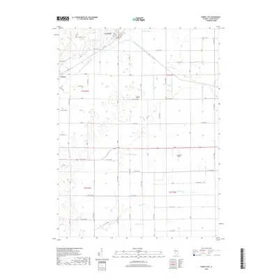
2018 Map of Forest City
USGS Topo · Published 2018About this map
Forest City and the small settlement of Bishop anchor this portion of Mason County, where the landscape is defined by an extensive network of drainage infrastructure. The presence of numerous waterways, such as the Mason Tazewell Drainage Ditch and White-and-Rowley-Ditch, indicates a long-standing regional effort to manage the local water table for agricultural productivity. This intricate system of channels, including the Waldmeier Ditch and Furrer Ditch, crisscrosses the low-lying terrain, illustrating the engineered transformation of the Illinois prairie. Locally significant landmarks like the Pleasant Hill Cem and Red Oak Ridge provide geographic focal points amidst the grid of rural roads and section lines. The map reveals how the early 21st-century rural economy remained tethered to this carefully maintained hydrology and the grid-based transport network of roads like Co RD 20.
Find a feature on this map
42 named features on this map. Tap any name to fly to it.
Don’t see what you’re looking for? This feature index may not catch every label — zoom into the map to look around manually.
Map Details
Editions of this 2018 Forest City Map
This is the sole edition of this map. No revisions or reprints were ever made.
Other maps of this area

1929 · Manito
USGS Topo · 1:62,500

1932 · Manito
USGS Topo · 1:62,500

1933 · Petersburg
USGS Topo · 1:62,500

1938 · Petersburg
USGS Topo · 1:62,500

1942 · Delavan
USGS Topo · 1:62,500

1948 · Mason City
USGS Topo · 1:62,500

1949 · Mason City
USGS Topo · 1:62,500

1958 · Peoria
USGS Topo · 1:250,000

1961 · Peoria
USGS Topo · 1:250,000

1963 · Peoria
USGS Topo · 1:250,000