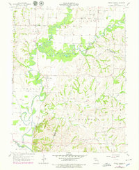
1956 Map of Forest Green
USGS Topo · Published 1979About this map
The Chariton River and its labyrinthine oxbows dominate this central Missouri landscape, where the shifting waters have carved out features like Horseshoe Lake and Duck Lake. This mid-century view shows a rural economy centered on small riverfront settlements such as Forest Green and the legacy of early industry at Lewis Mill. The complex hydrology of the region is evident in the confluence of the Middle Fork, East Fork, and Little Chariton River, which together create a fertile but flood-prone basin.
Find a feature on this map
28 named features on this map. Tap any name to fly to it.
Don’t see what you’re looking for? This feature index may not catch every label — zoom into the map to look around manually.
Map Details
Editions of this 1956 Forest Green Map
2 editions found
Other maps of this area

1890 · Glasgow
USGS Topo · 1:125,000

1947 · Glasgow
USGS Topo · 1:62,500

1953 · Moberly
USGS Topo · 1:250,000

1953 · Fayette
USGS Topo · 1:24,000

1953 · Armstrong
USGS Topo · 1:24,000

1953 · Clifton Hill
USGS Topo · 1:24,000

1954 · Moberly
USGS Topo · 1:250,000
1956 · Salisbury
USGS Topo · 1:24,000
1956 · Keytesville
USGS Topo · 1:24,000
1956 · Forest Green
USGS Topo · 1:24,000