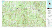
1984 Map of Forest
USGS Topo · Published 1994About this map
The Bienville National Forest dominates the heart of central Mississippi in this 1980s-era study, providing a comprehensive view of Scott, Rankin, and Smith Counties. The landscape is defined by the east-west corridor of Interstate 20 and the Illinois Central Gulf Railroad, which connect established communities like Pelahatchie, Morton, and Forest. While the northern edge is anchored by the Ross R Barnett Reservoir and the Pearl River, the interior reveals a mosaic of wildlife management areas such as Caney Creek and Tallahala. Small settlements and crossroads like Hillsboro, Piney Woods, and Puckett are mapped alongside distinct terrain features including Rattlesnake Prairie and Line Prairie, reflecting the transition from timbered uplands to the creek bottoms of Tallahala Creek and the Strong River.
Find a feature on this map
72 named features on this map. Tap any name to fly to it.
Don’t see what you’re looking for? This feature index may not catch every label — zoom into the map to look around manually.
Map Details
Editions of this 1984 Forest Map
2 editions found
Other maps of this area

1903 · Jackson
USGS Topo · 1:125,000

1905 · Jackson
USGS Topo · 1:48,000

1906 · Florence
USGS Topo · 1:62,500

1908 · Jackson
USGS Topo · 1:62,500

1908 · Florence
USGS Topo · 1:62,500

1921 · Forest
USGS Topo · 1:48,000

1922 · Forest
USGS Topo · 1:62,500

1922 · Morton
USGS Topo · 1:48,000

1922 · Pelahatchee
USGS Topo · 1:48,000

1924 · Pelahatchee
USGS Topo · 1:62,500