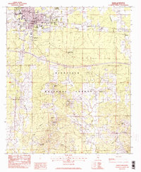
1982 Map of Forest
USGS Topo · Published 1983About this map
The city of Forest serves as the focal point of this Scott County landscape, situated at the northern edge of the Bienville National Forest. In the early 1980s, the community's infrastructure was defined by the Illinois Central Gulf railroad and the Forest Municipal Airport, while the Bienville Pines Scenic Area preserved a pocket of native woodland. The map reveals a deeply rooted rural society scattered south of the city, where small settlements like Fikestown and Norris were anchored by numerous community churches, including High Hill Ch and Mars Hill Ch.
Find a feature on this map
37 named features on this map. Tap any name to fly to it.
Don’t see what you’re looking for? This feature index may not catch every label — zoom into the map to look around manually.
Map Details
Editions of this 1982 Forest Map
2 editions found
Other maps of this area

1921 · Forest
USGS Topo · 1:48,000

1922 · Forest
USGS Topo · 1:62,500

1922 · Morton
USGS Topo · 1:48,000

1924 · Morton
USGS Topo · 1:62,500

1950 · Forest
USGS Topo · 1:62,500

1951 · Morton
USGS Topo · 1:62,500

1952 · Forest
USGS Topo · 1:62,500

1953 · Meridian
USGS Topo · 1:250,000

1957 · Meridian
USGS Topo · 1:250,000

1965 · Meridian
USGS Topo · 1:250,000