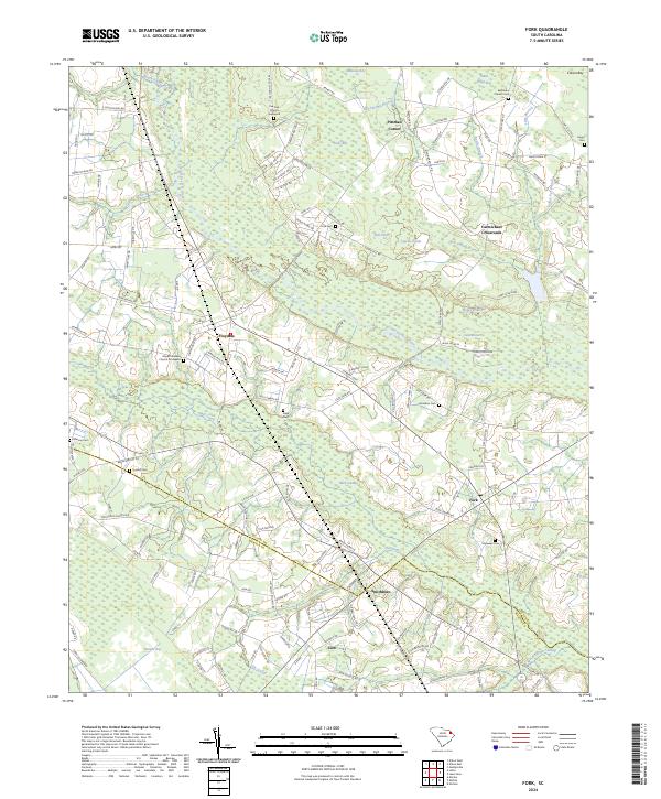
2024 Map of Fork
USGS Topo · Published 2024About this map
The Little Pee Dee River meanders through a landscape defined by significant wetland formations such as Buck Swamp, Tenmile Bay, and Maidendown Swamp. This agricultural and lowland region along the Dillon Co and Marion Co boundary is dotted with small rural settlements like Fork, Smithboro, and Floydale. The map reveals a high density of family and community burial grounds, including the Pee Dee Church Graveyard, Hopewell Cem, and Harrelson Cem, which serve as vital markers of local lineage.
Find a feature on this map
148 named features on this map. Tap any name to fly to it.
Don’t see what you’re looking for? This feature index may not catch every label — zoom into the map to look around manually.
Map Details
Editions of this 2024 Fork Map
This is the sole edition of this map. No revisions or reprints were ever made.
Other maps of this area

1943 · Pages Mill
USGS Topo · 1:62,500

1946 · Mullins
USGS Topo · 1:24,000

1947 · Marion
USGS Topo · 1:24,000

1947 · Mullins
USGS Topo · 1:24,000

1948 · Nichols
USGS Topo · 1:24,000

1950 · Nichols
USGS Topo · 1:24,000

1953 · Florence
USGS Topo · 1:250,000

1954 · Florence
USGS Topo · 1:250,000

1959 · Fork
USGS Topo · 1:24,000

1960 · Latta
USGS Topo · 1:24,000