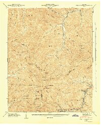
1946 Map of Fork Mountain
USGS Topo · Published 1947About this map
Smoky Mountain and Arch Mountain dominate this mid-century landscape at the intersection of Scott, Morgan, and Anderson counties. The eastern valley follows the New River corridor, where the Lumber Railroad and numerous inclines reveal an economy built on timber and resource extraction. Small settlements like Mooretown (Devonia PO), Tioga, and Braytown line the river, serving as vital hubs for the surrounding mountain communities.
Find a feature on this map
109 named features on this map. Tap any name to fly to it.
Don’t see what you’re looking for? This feature index may not catch every label — zoom into the map to look around manually.
Map Details
Editions of this 1946 Fork Mountain Map
2 editions found
Other maps of this area

1893 · Briceville
USGS Topo · 1:125,000

1895 · Wartburg
USGS Topo · 1:125,000

1895 · Briceville
USGS Topo · 1:125,000

1896 · Wartburg
USGS Topo · 1:125,000

1896 · Briceville
USGS Topo · 1:125,000

1935 · Gobey
USGS Topo · 1:24,000

1935 · Camp Austin
USGS Topo · 1:24,000

1936 · Hogbell Gap
USGS Topo · 1:24,000

1936 · Block
USGS Topo · 1:24,000

1936 · Duncan Flats
USGS Topo · 1:24,000