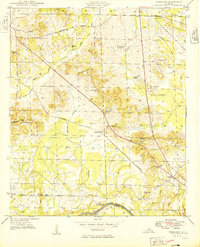
1949 Map of Forkland
USGS Topo · Published 1949About this map
The St Louis San Francisco railroad cuts diagonally across this Greene County landscape, connecting the landing at the Tombigbee River with interior settlements. The village of Forkland serves as a local hub near the southern river border, while smaller communities and family-named landmarks like Thornhill and Rosemont dot the higher ground. The map reveals a deeply established network of rural education and faith, with numerous institutions such as Bethlehem Sch, Cook Chapel Sch, and Zion Ch serving dispersed residents. Low-lying areas like Hagan Swamp and the bottomlands near McConnico Creek contrast with the surveyed hills. Genealogists will find significant value in the localized burial grounds, including Hard Bargain Cem and Bird Cem, which anchor the history of these specific family tracts and early Alabama settlements.
Find a feature on this map
49 named features on this map. Tap any name to fly to it.
Don’t see what you’re looking for? This feature index may not catch every label — zoom into the map to look around manually.
Map Details
Editions of this 1949 Forkland Map
2 editions found

Other maps of this area

1927 · Eutaw
USGS Topo · 1:48,000

1929 · Epes
USGS Topo · 1:48,000

1931 · Eutaw
USGS Topo · 1:62,500

1932 · Epes
USGS Topo · 1:62,500

1946 · Demopolis
USGS Topo · 1:24,000

1947 · Demopolis
USGS Topo · 1:24,000

1947 · Mason Bend
USGS Topo · 1:24,000

1947 · Forkland
USGS Topo · 1:24,000

1948 · Mason Bend
USGS Topo · 1:24,000

1948 · Mc Dowell
USGS Topo · 1:24,000