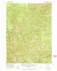
1955 Map of Forks of Salmon
USGS Topo · Published 1969About this map
Gold mining history and remote river settlements define this mid-century survey of the Salmon River and Klamath River confluence. The landscape is dotted with evidence of the region’s hydraulic and hard-rock mining legacy, including the Indian Bottom Mine, Morehouse Mine, and Sauerkraut Mine. Small outposts and river bars, some with colorful names like Murderers Bar and Three-dollar Bar, line the steep canyon floors. Local education and administration are represented by the Irving Creek Sch, Junction School, and the Oak Bottom Guard Sta.
Find a feature on this map
149 named features on this map. Tap any name to fly to it.
Don’t see what you’re looking for? This feature index may not catch every label — zoom into the map to look around manually.
Map Details
Editions of this 1955 Forks of Salmon Map
4 editions found

Other maps of this area

1914 · Seiad
USGS Topo · 1:125,000

1922 · Preston Peak
USGS Topo · 1:125,000

1922 · Seiad
USGS Topo · 1:125,000

1925 · Hoopa
USGS Topo · 1:125,000

1948 · Weed
USGS Topo · 1:250,000

1950 · Weed
USGS Topo · 1:250,000

1952 · Hoopa
USGS Topo · 1:62,500

1952 · Orleans
USGS Topo · 1:62,500

1955 · Dillon Mtn
USGS Topo · 1:62,500

1955 · Salmon Mtn
USGS Topo · 1:62,500