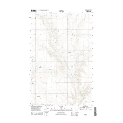
2014 Map of Forks
USGS Topo · Published 2014About this map
Forks and its surrounding prairie landscape in Phillips County are defined by a network of drainage coulees and gravel roads in this 2014 survey. The topography is shaped by the winding paths of Stinky Creek and its tributary, E Fork Stinky Cr, which carve through the high plains. For genealogists and local historians, the Forks Cem situated along Forks Rd remains a primary landmark for the community. The map also records several family-named geographical features, such as Ole Olson Coulee and Hymer Coulee, which speak to the area's agricultural and homesteading history. Transportation in this sparsely populated region relies on a few critical corridors, including Helmers Rd and Youth Ranch Rd, connecting isolated homesteads across the varied terrain of Water Coulee.
Find a feature on this map
16 named features on this map. Tap any name to fly to it.
Don’t see what you’re looking for? This feature index may not catch every label — zoom into the map to look around manually.
Map Details
Editions of this 2014 Forks Map
This is the sole edition of this map. No revisions or reprints were ever made.
Other maps of this area

1920 · Cowan
USGS Topo · 1:125,000

1954 · Glasgow
USGS Topo · 1:250,000

1957 · Glasgow
USGS Topo · 1:250,000

1958 · Glasgow
USGS Topo · 1:250,000

1968 · Tattnall
USGS Topo · 1:24,000
1968 · Hewitt Lake
USGS Topo · 1:24,000

1984 · Cole
USGS Topo · 1:24,000

1984 · Whitewater East
USGS Topo · 1:24,000

1984 · Double S Hill
USGS Topo · 1:24,000

1984 · Forks
USGS Topo · 1:24,000