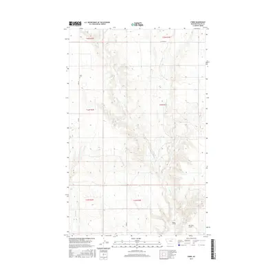
2017 Map of Forks
USGS Topo · Published 2017About this map
Forks and its surrounding landscape in Phillips County are defined by a network of drainage channels and coulees that shape the high plains of northern Montana. The settlement's history is anchored by the Forks Cem, situated just off Forks Rd. This 2017 survey reveals a terrain deeply etched by seasonal water flow, with the winding paths of Stinky Cr and its E Fork Stinky Cr moving through the township boundaries. The map highlights specific geographic features such as Water Coulee and Ole Olson Coulee, which serve as significant local landmarks for land management and history. This documentation of the area's rural road network, including the aptly named Cut Across Rd, provides a clear view of the sparse but critical infrastructure connecting these remote parts of the American West in the early 21st century.
Find a feature on this map
15 named features on this map. Tap any name to fly to it.
Don’t see what you’re looking for? This feature index may not catch every label — zoom into the map to look around manually.
Map Details
Editions of this 2017 Forks Map
This is the sole edition of this map. No revisions or reprints were ever made.
Other maps of this area

1920 · Cowan
USGS Topo · 1:125,000

1954 · Glasgow
USGS Topo · 1:250,000

1957 · Glasgow
USGS Topo · 1:250,000

1958 · Glasgow
USGS Topo · 1:250,000

1968 · Tattnall
USGS Topo · 1:24,000
1968 · Hewitt Lake
USGS Topo · 1:24,000

1984 · Cole
USGS Topo · 1:24,000

1984 · Whitewater East
USGS Topo · 1:24,000

1984 · Double S Hill
USGS Topo · 1:24,000

1984 · Forks
USGS Topo · 1:24,000