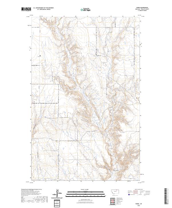
2024 Map of Forks
USGS Topo · Published 2024About this map
Forks Cem serves as a lone cultural landmark within this corner of Phillips County, situated along Forks Rd in the northwestern portion of the map. The landscape is defined by an intricate network of drainages and coulees that trace the region's complex topography. Prominent watercourses include Stinky Creek and its tributary, East Fork Stinky Creek, which carve through the terrain alongside namesake features like Joe Bell Coulee and Hymer Coulee.
Find a feature on this map
20 named features on this map. Tap any name to fly to it.
Don’t see what you’re looking for? This feature index may not catch every label — zoom into the map to look around manually.
Map Details
Editions of this 2024 Forks Map
This is the sole edition of this map. No revisions or reprints were ever made.
Other maps of this area

1920 · Cowan
USGS Topo · 1:125,000

1954 · Glasgow
USGS Topo · 1:250,000

1957 · Glasgow
USGS Topo · 1:250,000

1958 · Glasgow
USGS Topo · 1:250,000

1968 · Tattnall
USGS Topo · 1:24,000
1968 · Hewitt Lake
USGS Topo · 1:24,000

1984 · Cole
USGS Topo · 1:24,000

1984 · Whitewater East
USGS Topo · 1:24,000

1984 · Double S Hill
USGS Topo · 1:24,000

1984 · Forks
USGS Topo · 1:24,000