
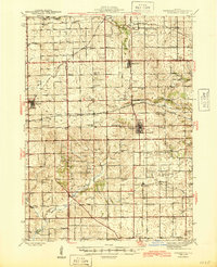
1945 Map of Forreston
USGS Topo · Published 1945About this map
Forreston sits at a critical junction of the Chicago Great Western and the Chicago Milwaukee St Paul and Pacific railroads, anchoring a landscape defined by its mid-century agrarian economy. The network of rural schools is remarkably dense on this sheet, featuring family-named locations such as Wall Sch, Keller Sch, and Marr Sch that served the farmsteads between Shannon and Baileyville.
Find a feature on this map
69 named features on this map. Tap any name to fly to it.
Don’t see what you’re looking for? This feature index may not catch every label — zoom into the map to look around manually.
Map Details
Editions of this 1945 Forreston Map
2 editions found
Other maps of this area

1918 · Dixon
USGS Topo · 1:62,500

1922 · Oregon
USGS Topo · 1:62,500

1924 · Oregon
USGS Topo · 1:62,500

1930 · Woodsung
USGS Topo · 1:48,000

1932 · Pecatonica
USGS Topo · 1:62,500

1934 · Morrison
USGS Topo · 1:48,000

1936 · Pecatonica
USGS Topo · 1:62,500

1937 · Lena
USGS Topo · 1:48,000

1939 · Freeport
USGS Topo · 1:48,000

1940 · Morrison
USGS Topo · 1:62,500