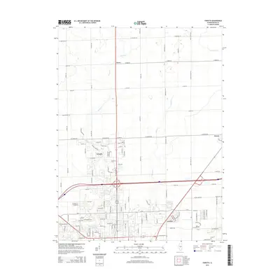
2015 Map of Forsyth
USGS Topo · Published 2015About this map
Forsyth and its surrounding communities sit at a major transition point north of Decatur, where suburban expansion meets the organized grid of central Illinois farmland. The landscape is defined by the drainage patterns of Stevens Cr and Spring Cr, which break the rectilinear road network with their meandering paths. This survey shows the infrastructure of a modern educational and residential hub, anchoring the region with the Richland Community Coll campus. To the east, the village of Oreana remains more distinct, while smaller locales like Emery and Larkdale mark the historical rail and road junctions that shaped Macon County. Long-standing local history is preserved at the Boiling Springs Cem and Garver Cem, providing fixed points of reference amidst the evolving developments of the early 21st century.
Find a feature on this map
100 named features on this map. Tap any name to fly to it.
Don’t see what you’re looking for? This feature index may not catch every label — zoom into the map to look around manually.
Map Details
Editions of this 2015 Forsyth Map
This is the sole edition of this map. No revisions or reprints were ever made.
Other maps of this area

1929 · Decatur
USGS Topo · 1:62,500

1933 · Decatur
USGS Topo · 1:62,500

1954 · Niantic
USGS Topo · 1:62,500

1957 · Kenney
USGS Topo · 1:62,500

1957 · Maroa
USGS Topo · 1:62,500

1958 · Peoria
USGS Topo · 1:250,000

1958 · Decatur
USGS Topo · 1:250,000

1961 · Peoria
USGS Topo · 1:250,000

1961 · Decatur
USGS Topo · 1:250,000

1963 · Peoria
USGS Topo · 1:250,000