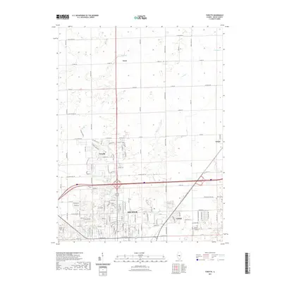
2021 Map of Forsyth
USGS Topo · Published 2021About this map
Decatur's northern reaches and the developing village of Forsyth dominate this central Illinois landscape, showing the transition from agricultural land to suburban expansion. The drainage of Stevens Cr and its tributaries carve through the terrain, historically shaping the layout of the local road network. The map identifies key educational and community landmarks such as Richland Community College, providing a record of the area's modern infrastructure. Smaller named points like Emery and Oreana sit on the periphery of the growing urban center, maintaining their distinct identity amidst the sprawling layout of regional routes like W Mound Rd and E Pershing Rd. For genealogists, the placement of Boiling Springs Cem and Garver Cem offers precise locations for ancestral research within Macon County.
Find a feature on this map
46 named features on this map. Tap any name to fly to it.
Don’t see what you’re looking for? This feature index may not catch every label — zoom into the map to look around manually.
Map Details
Editions of this 2021 Forsyth Map
This is the sole edition of this map. No revisions or reprints were ever made.
Other maps of this area

1929 · Decatur
USGS Topo · 1:62,500

1933 · Decatur
USGS Topo · 1:62,500

1954 · Niantic
USGS Topo · 1:62,500

1957 · Kenney
USGS Topo · 1:62,500

1957 · Maroa
USGS Topo · 1:62,500

1958 · Peoria
USGS Topo · 1:250,000

1958 · Decatur
USGS Topo · 1:250,000

1961 · Peoria
USGS Topo · 1:250,000

1961 · Decatur
USGS Topo · 1:250,000

1963 · Peoria
USGS Topo · 1:250,000