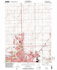
1998 Map of Forsyth
USGS Topo · Published 2001About this map
Decatur’s northern expansion dominates this late-twentieth-century landscape, where suburban growth meets the persistent grid of Macon County’s agricultural heritage. The community of Forsyth serves as a central hub, flanked by the residential pockets of Larkdale and Greens Switch. Institutional landmarks are prominent throughout the northern reaches of the city, including Stephen Decatur High Sch, Adlai E Stevenson Sch, and Our Lady of Lourdes Sch.
Find a feature on this map
28 named features on this map. Tap any name to fly to it.
Don’t see what you’re looking for? This feature index may not catch every label — zoom into the map to look around manually.
Map Details
Editions of this 1998 Forsyth Map
This is the sole edition of this map. No revisions or reprints were ever made.
Other maps of this area

1929 · Decatur
USGS Topo · 1:62,500

1933 · Decatur
USGS Topo · 1:62,500

1954 · Niantic
USGS Topo · 1:62,500

1957 · Kenney
USGS Topo · 1:62,500

1957 · Maroa
USGS Topo · 1:62,500

1958 · Peoria
USGS Topo · 1:250,000

1958 · Decatur
USGS Topo · 1:250,000

1961 · Peoria
USGS Topo · 1:250,000

1961 · Decatur
USGS Topo · 1:250,000

1963 · Peoria
USGS Topo · 1:250,000