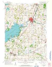
1961 Map of Fort Atkinson
USGS Topo · Published 1963About this map
The expansive waters of Lake Koshkonong dominate this Jefferson County landscape, serving as a focal point for mid-century lakeside communities and ancient landforms. The shoreline is dense with historical sites, from the earthworks at Sylvan Mounds and Koshkonong Mounds to the resort-era developments at Koshkonong Manor and Carcajou. The Rock River winds through the region, connecting the larger hub of Fort Atkinson to the north with the sprawling marshlands and smaller bays like Stinkers Bay and Binghams Bay.
Find a feature on this map
93 named features on this map. Tap any name to fly to it.
Don’t see what you’re looking for? This feature index may not catch every label — zoom into the map to look around manually.
Map Details
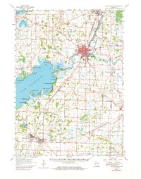
Editions of this 1961 Fort Atkinson Map
2 editions found
Other maps of this area

1890 · Sun Prairie
USGS Topo · 1:62,500

1890 · Stoughton
USGS Topo · 1:62,500

1891 · Waterloo
USGS Topo · 1:62,500

1891 · Koshkonong
USGS Topo · 1:62,500

1891 · Janesville
USGS Topo · 1:62,500

1892 · Watertown
USGS Topo · 1:62,500

1892 · Whitewater
USGS Topo · 1:62,500

1893 · Delavan
USGS Topo · 1:62,500

1893 · Whitewater
USGS Topo · 1:62,500

1893 · Janesville
USGS Topo · 1:62,500