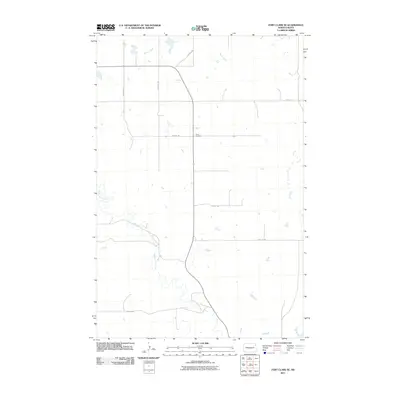
2011 Map of Fort Clark SE
USGS Topo · Published 2011About this map
Yucca Cemetery stands as a focal point in this section of Oliver County, where the high plains are carved by the winding paths of Square Butte Creek and Sherk Creek. This 2011 survey reveals a landscape of enduring agricultural patterns, defined by a rigid section-line road network that includes 29th Ave SW and 25th St SW. The terrain transition is evident as the drainage of Square Butte Creek meanders through the southern half of the quadrangle, illustrating the natural watercourses that have shaped the rural development of this region for generations. Genealogists and local historians can use this layout to pinpoint property locations and community landmarks within the sparse, organized grid of central North Dakota.
Find a feature on this map
11 named features on this map. Tap any name to fly to it.
Don’t see what you’re looking for? This feature index may not catch every label — zoom into the map to look around manually.
Map Details
Editions of this 2011 Fort Clark SE Map
This is the sole edition of this map. No revisions or reprints were ever made.
Other maps of this area

1907 · Bismarck
USGS Topo · 1:125,000

1950 · Wilton
USGS Topo · 1:62,500

1951 · Bismarck
USGS Topo · 1:62,500

1954 · Bismarck
USGS Topo · 1:250,000

1954 · McClusky
USGS Topo · 1:250,000

1958 · Bismarck
USGS Topo · 1:250,000

1958 · McClusky
USGS Topo · 1:250,000

1962 · Harmon
USGS Topo · 1:24,000

1966 · Price
USGS Topo · 1:24,000
1966 · Sanger
USGS Topo · 1:24,000