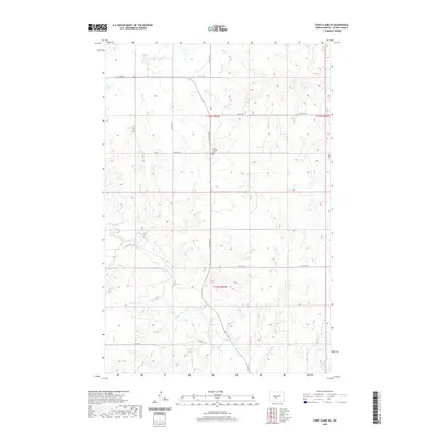
2020 Map of Fort Clark SE
USGS Topo · Published 2020About this map
Yucca Catholic Cem stands as a central landmark in this portion of Oliver County, situated at the intersection of 23rd St SW and 27th Ave SW. The landscape is defined by the drainage patterns of Square Butte Cr in the south and Sherk Cr in the north, which carve through the terrain of t142n r82w and t141n r82w. The rectilinear grid of the Public Land Survey System is mirrored by a network of rural roads, such as 21st St SW and 29th Ave SW, which facilitate movement across this agrarian expanse. This topographic study emphasizes the intersection of natural watercourses and the human-imposed township and range system, providing a clear record of the area's development and land division in the early 21st century.
Find a feature on this map
16 named features on this map. Tap any name to fly to it.
Don’t see what you’re looking for? This feature index may not catch every label — zoom into the map to look around manually.
Map Details
Editions of this 2020 Fort Clark SE Map
This is the sole edition of this map. No revisions or reprints were ever made.
Other maps of this area

1907 · Bismarck
USGS Topo · 1:125,000

1950 · Wilton
USGS Topo · 1:62,500

1951 · Bismarck
USGS Topo · 1:62,500

1954 · Bismarck
USGS Topo · 1:250,000

1954 · McClusky
USGS Topo · 1:250,000

1958 · Bismarck
USGS Topo · 1:250,000

1958 · McClusky
USGS Topo · 1:250,000

1962 · Harmon
USGS Topo · 1:24,000

1966 · Price
USGS Topo · 1:24,000
1966 · Sanger
USGS Topo · 1:24,000