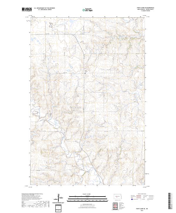
2024 Map of Fort Clark SE
USGS Topo · Published 2024About this map
Yucca Catholic Cem stands as a focal point of heritage in this upland region of Oliver County. The landscape is defined by the winding course of Square Butte Creek, which carves through the central and southern sections of the quadrangle, joined by Sherk Creek in the northeast. This 2024 survey depicts a sparsely populated agricultural environment organized by a strict grid of section lines and gravel roads, including 27th Ave SW and 21st St SW. The terrain's rolling topography is meticulously detailed, showing the natural drainage patterns that flow toward the Missouri River basin. The map serves as a contemporary record of the Public Land Survey System boundaries, specifically within T142n R82w and adjacent townships, reflecting the enduring rural character and land use patterns of the Great Plains.
Find a feature on this map
16 named features on this map. Tap any name to fly to it.
Don’t see what you’re looking for? This feature index may not catch every label — zoom into the map to look around manually.
Map Details
Editions of this 2024 Fort Clark SE Map
This is the sole edition of this map. No revisions or reprints were ever made.
Other maps of this area

1907 · Bismarck
USGS Topo · 1:125,000

1950 · Wilton
USGS Topo · 1:62,500

1951 · Bismarck
USGS Topo · 1:62,500

1954 · Bismarck
USGS Topo · 1:250,000

1954 · McClusky
USGS Topo · 1:250,000

1958 · Bismarck
USGS Topo · 1:250,000

1958 · McClusky
USGS Topo · 1:250,000

1962 · Harmon
USGS Topo · 1:24,000

1966 · Price
USGS Topo · 1:24,000
1966 · Sanger
USGS Topo · 1:24,000