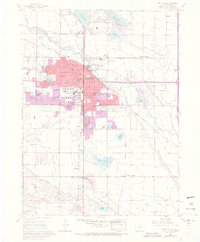
1960 Map of Fort Collins
USGS Topo · Published 1970About this map
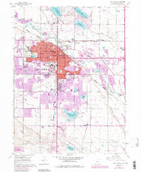
Colorado State University anchors the central landscape of this northern Colorado college town during a period of significant mid-century expansion. The urban footprint of Fort Collins is documented with 1969 photorevisions, showing growth spreading south toward Warren Lake and east past the Sugar Refinery. Industrial and agricultural roots remain visible through the irrigation network of the Cache La Poudre River and the presence of workers' neighborhoods like Andersonville and Buckingham. The rural periphery is dotted with historic waypoints including McClellands and Black Hollow Junction, along with several outlying schools and cemeteries such as Harmony Cem. This survey illustrates the transition from a rail-dependent agricultural center, served by the Union Pacific and Colorado and Southern lines, into a modern educational and residential hub.
Find a feature on this map
55 named features on this map. Tap any name to fly to it.
Don’t see what you’re looking for? This feature index may not catch every label — zoom into the map to look around manually.
Map Details
Editions of this 1960 Fort Collins Map
6 editions found
Other maps of this area

1902 · Greeley
USGS Topo · 1:125,000

1906 · Loveland
USGS Topo · 1:62,500

1906 · Fort Collins
USGS Topo · 1:62,500

1907 · Livermore
USGS Topo · 1:125,000

1908 · Loveland
USGS Topo · 1:62,500

1908 · Fort Collins
USGS Topo · 1:62,500

1908 · Eaton
USGS Topo · 1:125,000

1909 · Livermore
USGS Topo · 1:125,000

1910 · Eaton
USGS Topo · 1:125,000

1950 · Windsor
USGS Topo · 1:24,000