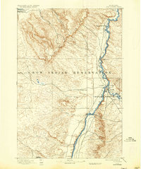
1894 Map of Fort Custer
USGS Topo · Published 1936About this map
The Fort Custer Military Reservation dominates the eastern landscape of this 1890s survey, situated at the confluence of the Big Horn River and the Little Horn. This map captures a pivotal moment in the frontier era, depicting the transition of the region through military presence and the establishment of the Crow Indian Reservation. The terrain is defined by the prominent Pine Ridge and the iconic Pompeys Pillar to the northwest, a significant landmark along the N. P. railroad line.
Find a feature on this map
20 named features on this map. Tap any name to fly to it.
Don’t see what you’re looking for? This feature index may not catch every label — zoom into the map to look around manually.
Map Details
Editions of this 1894 Fort Custer Map
4 editions found
Other maps of this area

1893 · Huntley
USGS Topo · 1:125,000

1894 · Rosebud
USGS Topo · 1:125,000

1894 · St. Xavier
USGS Topo · 1:125,000

1894 · Fort Custer
USGS Topo · 1:125,000

1901 · Rosebud
USGS Topo · 1:125,000

1901 · St. Xavier
USGS Topo · 1:125,000

1915 · Spenceville
USGS Topo · 1:31,680

1954 · Billings
USGS Topo · 1:250,000

1954 · Hardin
USGS Topo · 1:250,000

1954 · Forsyth
USGS Topo · 1:250,000