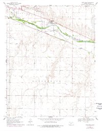
1969 Map of Fort Dodge
USGS Topo · Published 1978About this map
Fort Dodge and the southeastern edge of Dodge City anchor this 1960s survey along the banks of the Arkansas River. The landscape reveals a mix of mid-century infrastructure and agricultural utility, from the expansive Feed Lot in the north to the Gravel Pit operations near the riverbank. Industrial and social markers such as the Home for Boys, a Powerplant, and Riverview Camp indicate the diverse use of land outside the main city center during this era.
Find a feature on this map
23 named features on this map. Tap any name to fly to it.
Don’t see what you’re looking for? This feature index may not catch every label — zoom into the map to look around manually.
Map Details
Editions of this 1969 Fort Dodge Map
2 editions found

Other maps of this area

1892 · Dodge
USGS Topo · 1:125,000

1892 · Spearville
USGS Topo · 1:125,000

1894 · Spearville
USGS Topo · 1:125,000

1955 · Pratt
USGS Topo · 1:250,000

1955 · Dodge City
USGS Topo · 1:250,000

1958 · Dodge City
USGS Topo · 1:250,000

1959 · Pratt
USGS Topo · 1:250,000

1959 · Dodge City
USGS Topo · 1:250,000

1968 · Dodge City
USGS Topo · 1:24,000
1969 · South Dodge
USGS Topo · 1:24,000